


 |
| A New Universal Atlas Containing Maps of the various Empires, Kingdoms, States and Republics Of The World. With a special map of each of the United States, Plans of Cities &c. Comprehended in seventy sheets and forming a series of One Hundred And Seventeen Maps, Plans And Sections ... Philadelphia, Published By S. Augustus Mitchell, N.E. corner of Market & 7th Streets. 1846. Entered ... 1846, by H.N. Burroughs ... Pennsylvania. (title page by) J. Knight Sc. |
The reason for listing all these digitized map links is twofold; first to produce the links and provide the information, second to illustrate the fact that searching online can be an endlessly productive activity. I am always skeptical of anyone's claims that they have searched all the available records. Every time I returned to this project, I found more links and no, I did not go to any one source and simply copy someone's work. In some cases, I incorporated part of the list from a particular website, but I did not find anyplace where all these websites were listed. I also intend to incorporate all this information in the FamilySearch.org Research Wiki over the next few weeks (months?).
The attention of the genealogical community has been focused on maps available through huge online repositories and portals. Some of the largest of these include the following:
- OldMapsOnline.org
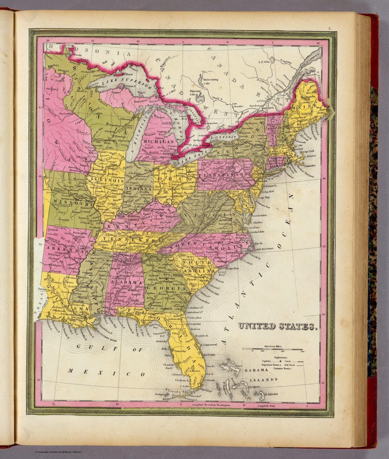
- The David Rumsey Map Collection
- The Perry-Castañeda Library Map Collection
- Maps: Scanned collections online from the British Library
- Trove.nla.gov.au Maps
- The New York Public Library
- The Library of Congress
- USGS Topographical Map Collections including historical topographical maps
- Western Waters Digital Library
- Michigan State University, Using Sanborn Fire Insurance Maps Online
- Ancestry.com
- Archive.org
- Digital Public Library of America
- United States Census Bureau State and County Map
- Historic Map Works
- Newberry Atlas of Historical County Boundaries
- University of Texas at Austin, Historical Maps Websites
- American Geographical Society - Digital Map Collection
- Ancient World Mapping Center - Maps for Students
- Digtal-Topo-Maps.com
- National Archives, Cartographic and Architectural Records
- Public Domain Sherpa, Public Domain Maps
- Olin and Uris Libraries, Cornell University, GIS Data and Maps, United State
- Index to Digital USGS 15 Minute Topographical Maps
- Map History, Images of early maps on the web
- DigitalStateArchives.com
- University of New Hampshire, Historic USGS Maps of New England and New York
- Rails and Trails, Historic Transportation Sources
- NationalAtlas.gov
- US Forest Service Maps
There are many, many more that could be listed. You can, of course, search any one or all of these large online collections for maps of the individual states of the United States and other places around the world. Please excuse any duplications in links. Sometimes, the link applied to more than one state and sometimes it was difficult to tell if the links went to the same website or not.
However, in the United States, it is important to note that there are also significant map collections in most states. The following is a listing of some of the map collections available for each state in the United States. I have included some of the larger collections. Please understand that this list is not exhaustive. You may find even more online locations by searching for "state name map collections." Of course, there are huge numbers of paper maps available in libraries and other repositories across the country, but many of those are merely copies of maps already digitized. Have a good time looking at and searching all these maps.
It is interesting to see that some states have extensive digital map collections and other have practically nothing online. In Arizona, for example, both the state universities have huge map collections but practically none of those are digitized or available online. This also reflects the condition of the rest of the state archives, some have huge collections online such as the State of Washington, others practically nothing. Also, some of these state collections contain maps from all over the United States and world.
Alabama
- University of Alabama Map Collection
- Alabama State Maps Collection
- Alabama Maps
- Alabama County Maps and Atlases
- Alabama Dept. of Transportation maps
- Alabama Genealogy: Maps
- Alabama Maps
- Alabama County Maps
- The History of the Black Belt
- Geologic and Geographic Setting
- Alabama maps, The Perry-Castañeda Library Map Collection, The University of Texas at Austin
- Panoramic Maps, 1847-1929
- Joe's Alabama Road History
- Birmingham Public Library Digital Collections
Alaska
American Samoa
Arizona
Arkansas
California
- California Historic Topographic Map Collection, California State University, Chico
- California Geological Survey, Geologic Maps
- Maps of California
- Historical Maps of Southern California
- University of California, Berkeley Earth Sciences and Map Library
- Los Angeles County Historical Topographical Maps
- SDAG Historical Topographical Maps, San Diego County
- UCLA Library, Digital Collections
- Online Archive of California
- Humboldt State University Library, Digital Spatial Data
- Stanford University, Digital Collections, Glen McLaughlin Map Collection
- Los Angeles Public Library, Map Collection
- San Fernando Valley History Digital Library
- Stanford University, Branner Earth Sciences Library and Map Collections
- Cal-Atlas Geospatial Clearinghouse
- Historic topographic maps of California, U.C. Berkeley
- Digital Atlas of California
- Los Angeles County Historical Topographic Maps
- Los Angeles County Metropolitan Transit Authority
- Los Angeles and the Problem of Urban Historical Knowledge: Maps
- Official Los Angeles city web site
- Los Angeles County Office of the Assessor
- Navigate LA
Colorado
- Colorado BLM GIS/Mapping Science
- Colorado Colorado Atlas of Panoramic Aerial Images
- Maps of Colorado
- Colorado State University Libraries, Digital Collections
- Colorado Virtual Library
- University of Colorado, Digital Library
- University of Colorado, Boulder, Building Colorado Story by Story: The Sanborn Fire Insurance Map Collection
- Western Waters Digital Library, Digital Collections of Colorado
- Denver Public Library, Western History and Genealogy
- University of Northern Colorado, The Atlas of Colorado
Connecticut
Delaware
District of Columbia
Florida
- Florida Data Directory
- Florida Department of Environmental Protection
- University of South Florida Libraries, Digital Collections
- Maps of Florida
- University of Florida, Digital Collections
- Florida Electronic Library, Florida Maps Collection
- State University of Florida, Publication of Archival Library and Museum Materials
- Digital Library of the Caribbean
- University of Central Florida, Florida Digital Collections
- Florida International University, Digital Collections Center
- Jacksonville Public Library, Digital Library Collection
- Florida State Archives, Florida Memory Project
- University of Miami, Old Florida Maps
Georgia
- University of Georgia, Hargrett Rare Map Collection (not digitized)
- Digital Library of Georgia
- Georgia State University, University Library, Historical Atlanta Maps
- Guide to Sanborn Fire Insurance Maps, Georgia State University
- Georgia Historical Society
- Maps of Georgia
- University of Georgia Rare Books and Manuscripts - Digital Collections (includes maps)
Guam
Hawaii
Idaho
- Idaho State Historical Society
- University of Idaho Library, Digital Initiatives
- University of Idaho Library, Maps
- Maps of Idaho
- Idaho State University, Department of Special Collections and University Archives
- Idaho Genealogical Society
- Boise State University, Idaho Research
- Brigham Young University, Idaho, David O. McKay Library, Maps
- IDGenWeb Project, Idaho Maps and Places
- University of Idaho and the Portneuf Library, The Idaho Map Room
- Idaho Commission for Libraries, FARRIT, Idaho History
Illinois
- Encyclopedia of Chicago
- Genealogy Online
- Historical Maps Online
- Homicide in Chicago 1870-1930, Northwestern University
- Illinois Harvest (University of Illinois at Urbana-Champaign)
- Illinois Historical Digitization Projects
- Illinois Periodicals Online
- Illinois State Archives Databases
- University Libraries, Ball State University, Digital Media Repository
- Maps of Illinois
- University of Illinois at Urbana-Champaign, University Library, Historical Maps Online
- Illinois Digital Archives, Maps
- Northwestern University Library, Our Road Trip Issue: Old Illinois Highway Maps and Cost of Gas
- University of Chicago Library, Archival and Manuscript Collections, Map Collection
- USGenWeb Project, Illinois Digital Map Library
Indiana
- Indiana University - Purdue University, Indianapolis, Historic Indiana Plat books
- Ball State University Digital Media Repository (Browse)
- Hoosier Heritage Digital Library
- Indiana Historical Society - Digital Image Collections
- Indiana Magazine of History Online Index
- Indiana-Related Datases & Indexes, Indiana State Library
- The Indiana Geographic Information Council
- Maps of Indiana
- Indiana University-Purdue University Indianapolis, Historic Indiana Maps
- Indiana University, Image Collections Online, Indiana Historic Maps
- Indiana University, Bloomington, Indiana Digital Atlas Collection
- Indiana University, Indiana Spatial Data Portal
- Indiana Historical Society
- Indiana Commission on Public Records, Aerial Photographs and Historic Maps
- Indiana State Library, Map Collection
- Indiana Department of Transportation maps
- Indiana Map (IGIC)
- University of Iowa Libraries, Iowa Counties Historic Atlases
- Maps of Iowa
- University of Iowa Libraries, Iowa Maps Digital Collection
- Iowa Geographic Map Server
- Iowa City and Johnson County, Digital History Project
- University of Northern Iowa, Rod Library, Regional Geography: Iowa
- Iowa Department of Natural Resources, Aerial Photography
Kansas
- The Kansas Collection
- Territorial Kansas Online
- Maps of Kansas
- Wichita State University Libraries, Department of Special Collections, A Collection of Digitized Kansas Maps
- Kansas Historical Society, Maps
- Kansas Memory
- Kansas State University, Digital Collections
- Fort Hays State University, Forsyth Library Digital Collections
- Territorial Kansas
Kentucky
- Kentucky Digital Library
- Maps of Kentucky
- University of Louisville, Kentucky Maps
- Kentucky Historical Society, Maps and Atlases
- University of Kentucky Libraries, Historic Maps
- University of Kentucky Libraries, Special Collections Library
- Eastern Kentucky University Libraries, Special Collections and Archives
- KyGeoportal
Louisiana
- LOUISiana Digital Library
- Maps of Louisiana
- Tulane University Digital Library
- Atlas: The Louisiana Statewide GIS
- New Orleans Public Library, Louisiana Map Collection
- Louisiana Digital Library
- Tulane University, Howard-Tilton Memorial Library, Digital Initiatives
- Louisiana State University, Special Collections, Louisiana and Lower Mississippi Valley Collections
Maine
- Maine Geological Survey
- Maine Geographic Information Systems
- Maine Memory Network
- Maps of Maine
- Maine State Archives
- Windows on Maine
- University of Maine System Libraries, Digital Collections
- Maine Historical Society, Brown Library
- Maine State Library, Map Web Resources
- University of Southern Maine, Osher Map Library
Maryland
- Maryland Digtal Cultural Heritage
- Maryland State Archives Museum and Outreach
- Maps of Maryland
- University of Maryland, Special Collections and University Archives, Maryland Map Collection
- Maryland Historical Society, Special Collections: Maps and Atlases
- Maryland State Archives
- Johns Hopkins University, Sheridan Libraries, Special Collections and Archives, Garrett Map Collection
Massachusetts
- Harvard University’s Map Collection. Early Massachusetts maps
- Boston Subsurface Project
- Boston Streets. Digitized historical atlas of the Boston Area. Tufts University
- Digital Commonwealth, Massachusetts Collections Online
- Maps of Massachusetts
- Northeast Massachusetts Digital Library
- Massachusetts Historical Society, Massachusetts Maps
- University of Massachusetts, Amherst Libraries, Massachusetts Maps
- Special Collections and Archives Historic Maps
Michigan
- The Making of Modern Michigan
- Maps of Michigan
- Northern Michigan University, Lydia M. Olson Library, Maps, Atlases and GIS
- Michigan State University Map Collection
- University of Michigan Map Library
- Michigan Department of Education, MeL Michigana, Digital Projects
- University of Michigan, Michigan County Histories and Atlases
- Michigan Historical Center, Seeking Michigan
- Archives of Michigan
- Statewide Search for Subdivision Plats
- Western Michigan University, Digitized Collections
- Farmington Community Library Local History and Genealogy Resources
Minnesota
- Minnesota Digital Library
- Maps of Minnesota
- Minnesota Historical Society, The Michael Fox Map Collection, Minnesota Maps
- University of Minnesota, John R. Borchert Map Library, Digitized Plat Maps and Atlases
- Minnesota Digital Library
- Minnesota Geospatial Information Office
- Minneapolis Historical Records and Property History
- The Itawamba Historical Society, Online Digital Archives
Mississippi
- Mississippi Digital Library
- Maps of Mississippi
- Mississippi Department of Archives and History, Historical Map Collection
- Mississippi Maps
- University of Southern Mississippi, Digital Collections
- University of Mississippi Libraries, Archives and Special Collections
- Mississippi State University, Special Collections
- USGenWeb Mississippi Digital Map Library
Missouri
- University of Missouri Library Systems, Digital Library
- Missouri Digital Heritage
- Maps of Missouri
- The Kansas City Public Library, Missouri Valley Special Collections, Maps
- University of Missouri, Kansas City, Libraries, Digital Collections
- Missouri History Museum
- Unreal City, Historic St. Louis Maps
- University of Missouri Libraries, Special Collections and Rare Books, Digital Collections and Exhibits
- The State Historical Society of Missouri
- Missouri State University, Digital Collections
- Washington University Digital Gateway
Montana
Nebraska
Nevada
New Hampshire
New Jersey
- New Jersey State Archives
- Maps of New Jersey
- Historical Maps of New Jersey, Rutgers University
- Rutgers University Libraries, Special Collections and University Archives
- Princeton Public Library, Genealogy
- Princeton University, Historic Maps Collection
- Trenton Free Public Library, Trentoniana Historic Map Collection
- New Bunswick Free Public Library, Local History and Genealogy
- Rutgers University, Maps of New Jersey
- Rutgers University, Cartography
New Mexico
New York
- Hudson River Valley Heritage
- New York State Library
- Maps of New York
- Syracuse University Digital Collections
- USMA Library, Digital Collections
- New York Public Library, Digital Gallery Historic Map Guide
- New York Public Library, Open Access Maps
- New York State Library Selected Digital Historical Documents
- State University of New York at Stony Brook, New York State Historical Maps
- University of Albany, MapNY
- New York State Map Pathfinder
- New York University Libraries, New York City, Maps and Atlases
North Carolina
- North Carolina Digital Heritage
- North Carolina State Archives
- Eastern North Carolina Digital Library
- ECHO
- Maps of North Carolina
- North Carolina State University, Historical Data and Maps
- State Archives of North Carolina, Digital Collections and Publications
- North Carolina Maps
- North Carolina State University Libraries, Historical Data and Maps
- University of North Carolina at Greensboro, Online Collections
- DigtalNC
- East Carolina University, Eastern North Carolina Digital Library
- Forsyth County Public Library, North Carolina Room
- Davidson County, North Carolina, Maps
- Craven County Digital History Exhibit
- North Carolina Geological Survey, Maps and aerial photographs
- NC.gov
- Duke University, Maps
North Dakota
Northern Marianas Islands
Ohio
- Cleveland Digital Library
- Maps of Ohio
- Cleveland Memory Project
- The Southeastern Ohio Digital Shoebox Project
- Greater Cincinnati Memory Project
- Ohio Historical Society
- State Library of Ohio Digital and Special Collections
- Ohio State University Libraries, Maps
- USGenWeb, Ohio Digital Map Library
- The Public Library of Cincinnati and Hamilton County, Virtual Library, Digital Maps
- Ohio University Libraries, Digital Collections
- Ohio Department of Transportation, Maps Resource Page
- Ohio Memory
- Rails and Trails, Historic Transportation Maps
- Toledo's Attic
- Miami University Libraries, Digital Collections
Oklahoma
Oregon
Pennsylvania
Puerto Rico
Rhode Island
South Carolina
South Dakota
Tennessee
Texas
- University of Houston, Digital History
- Maps of Texas
- University of Texas Libraries, Perry-Castañeda Library Map Collection
- Texas Map Society
- University of North Texas, Libraries, Portal to Texas History
- Texas State Historical Association
- Stephen F. Austin State University, Ralph W. Steen Library, Digital Archives and Collections
- University of Texas, Arlington, Digital Collections and Exhibits
- Texas A and M University Libraries, Digital Library
- Texas Tech University Libraries, Digital Collections
- Baylor University, Texas Collection, Maps
- Texas State University, Collections and Archives
Utah
- Pioneer, Utah's Online Library
- Maps of Utah
- Utah Digital Map Library
- Brigham Young University, Harold B. Lee Library, Collections
- Utah State University Digital Collections
- University of Utah, J. Willard Marriott Library, Sanborn Insurance Maps
- University of Utah, Digital Library
- Southern Utah University, Gerald R. Sherratt Library, Special Collections, Digital Archives
- Weber State University, Digital Collections
Vermont
Virginia
Virgin Islands
Washington
- Washington State University, Manuscripts, Archives and Special Collections, Historic Map Collection
- Maps of Washington
- Washington State Library, Maps
- Legacy Washington, Historic Maps
- Washington State University, Early Washington Maps
- University of Washington, Libraries, Map Collection and Cartographic Information Services
- University of Washington, Tacoma, Digital Collections
- Eastern Washington University Libraries Digital Collections
- University of Washington Bothell, Digital Collections and Services
West Virginia
Wisconsin
- University of Wisconsin, Milwaukee, American Geographical Society Library, Digital Map Collection
- Maps of Wisconsin
- University of Wisconsin Digital Collections
- University of Wisconsin, The State of Wisconsin Collection
- Wisconsin Historical Society, Maps and Atlases in Our Collections
- University of Wisconsin, Milwaukee, AGSL Digital Collections Portal
- Milwaukee Public Library, Recollection Wisconsin
- University of Wisconsin, Eau Claire, Special Collections and Archives
- University of Wisconsin, Superior, Special Collections Digital Resources
- InfoSoup
- Madison Public Library, History and Genealogy
- Wisconsin Historical Society, Central Wisconsin Digitization Project
- University of Wisconsin, River Falls, University Archives and Area Research Center
- Genealoger.com
- Wisconsin Digital Map Library
Wyoming
Wow! What a great list. Thanks for sharing.
ReplyDeleteA phenomenal list, James! Thank you for taking the time to put it together. I have many of these, but any one map might be the one needed to move forward. I so love maps!!
ReplyDeleteI can't tell you how happy I am to get this! Thank you so much.
ReplyDeleteHere is a great map over the years of the City of Pittsburgh, I love your list. I have posted the link on my Blog "Oakmont Genealogy Study Group"
ReplyDeleteOn the Pittsburgh map you can trace the changes through the years.
http://peoplemaps.esri.com/pittviewer/
Bookmarked! Thank you!
ReplyDeleteThere are 3 city maps with names of deedholders-
ReplyDeletePittsburgh, PA- http://peoplemaps.esri.com/pittsburgh/
Cleveland, Ohio- http://peoplemaps.esri.com/cleveland/
Toronto, Canada- http://peoplemaps.esri.com/toronto/
I didn't see http://mapofus.org on the list. My team and I have loved using this for client projects for years because you can see county boundaries change over time - extremely helpful. We wrote about it here: http://genealogistsblog.legacytree.com/2014/07/early-united-states-maps-we-love.html
ReplyDelete