Old maps are fascinating. In the past, they were rare and hard to find. If you actually had an old map, it was likely a collectors item and not something you could pull out on a trip to find a location. Today, if there is one area of genealogy that is practically saturated by digital images it is maps. We have detailed satellite images of every square inch of the earth. With Google Maps Street View, I can look at most of the paved roads in many parts of the world as if I were actually driving down the road. Additionally, there are hundreds of thousands of maps online, complete, digitized and available, for the most part, free to the public with an Internet connection.
But so what? What use is there for this vast resource of digitized historical maps? How do you go abotu using maps in your genealogy? Maps are a tool and like any tool, there are certain skills associated with using them. Without those skills, the maps are nothing but pretty images. With those skills maps become a valuable historical and genealogical resource.
One of the reasons why old maps are valuable is because they give us a graphic representation of the ways our ancestors viewed the world and named the geographical features that surrounded them. Without searching an old map, sometimes references in our ancestors' histories are virtually undecipherable. Old maps open the door to understanding where our ancestors lived, or thought they lived. Maps, old or new, also give us a physically demonstrable connection with our ancestors' lives. If we can see where they lived, we know more about how they lived and can better understand the challenges of their lives. The first thing I always do when I am asked about finding an ancestor is go to the maps to see exactly where these people lived. That gives me an image in my mind to start my research. My experience is that the solution to many, if not most, genealogical mysteries can be assisted by carefully locating the events on old and new maps.
Fortunately, through developing imaging techniques, you can now compare an old map with a new one by means of overlaying the old map on the newer one. One early implementation of this technology was used in Google Earth, a free downloadable program from Google. Google Earth implemented an overlay of selected maps from the David Rumsey Map Collection. The feature is not obvious, you have to closely look at the list of overlays in the Google Earth Gallery and check the box for David Rumsey Maps to activate the feature. Then the small icons for the maps will appear on Google Earth where they can be viewed and will be automatically adjusted to "fit" the new map. You have to be careful not to add too many different kinds of overlays from the Gallery at once or the screen will get too cluttered with icons. Here is a screen shot showing the use of the overlay in Google Earth:
The historic map is the light colored overlay. You have to zoom in to see the details.
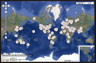
Google is adding this feature to its Google Maps product also. Presently, there are over 120 historical maps in the Google Maps have been selected by David Rumsey from his collection of more than 150,000 historical maps; in addition, there are a few maps from collections with which he collaborates. Here is a screen shot from the David Rumsey Maps website showing the location of the historical maps in Google Maps:
This technology is not unique to Google. There is a similar program on the website for the New York Public Library. You can see a demo of this product called the Warper, in the video at the beginning of this post. Here is an example of a map from the New York Public Library before rectification:
Here is a screen shot of the same map adjusted to the new map (rectification):
As you zoom in on a map, you can then see any differences and correspondences between the old, historic map and the up-to-date version of the same area.
You may also wish to explore the David Rumsey Map website for additional apps and features.


No comments:
Post a Comment